
Public
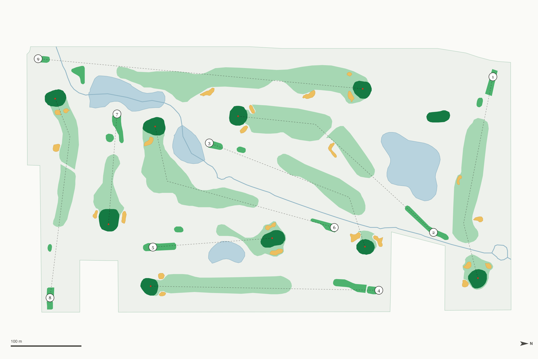
Bunkers, water and walkability are measured from OpenStreetMap data (© OpenStreetMap contributors), with elevation from USGS 3DEP. Walkability weighs green-to-tee walks and climbing.
| Tee | Yards | Par | Rating | Slope |
|---|---|---|---|---|
| Blue | 2,910 | 35 | 33.9 | 123 |
| White | 2,658 | 35 | 32.7 | 115 |
| Red | 2,466 | 35 | 32.0 | 103 |
| Hole | 1 | 2 | 3 | 4 | 5 | 6 | 7 | 8 | 9 | Tot |
|---|---|---|---|---|---|---|---|---|---|---|
| Blue | 322 | 397 | 310 | 354 | 195 | 345 | 163 | 323 | 501 | 2,910 |
| White | 305 | 349 | 300 | 324 | 152 | 330 | 141 | 307 | 450 | 2,658 |
| Red | 283 | 327 | 270 | 309 | 149 | 315 | 131 | 240 | 442 | 2,466 |
| Par | 4 | 4 | 4 | 4 | 3 | 4 | 3 | 4 | 5 | 35 |
Ratings and scorecards as reported to GolfCourseAPI; the Difficulty Index is calculated from them. Ratings are men's unless marked W. Check with the course before relying on them for a handicap.